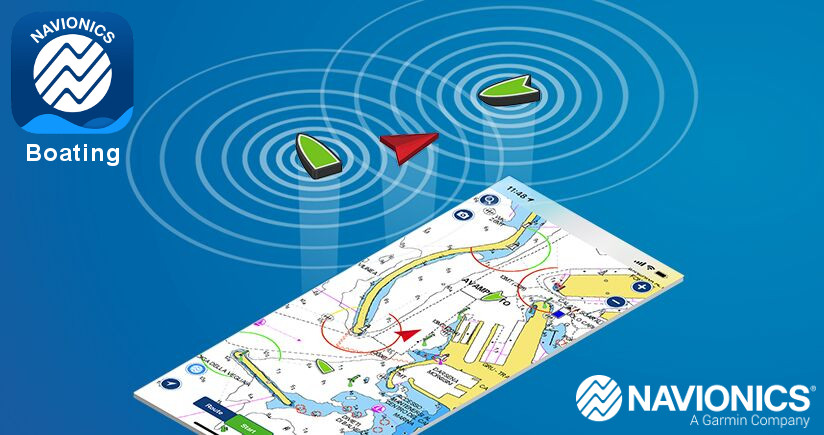
Navionics Boating App-Is It The Best?
Navigating the open waters can be both exciting and challenging, making it crucial for boaters to have reliable tools at their fingertips. One such tool that has garnered attention in recent years is the Navionics Boating App. Offering a wide range of features, this app has become a must-have for cruising, fishing, sailing, diving, and other activities on the water. Compatible with both Apple and Android devices, the app ensures essential information is easily accessible wherever boaters may venture.
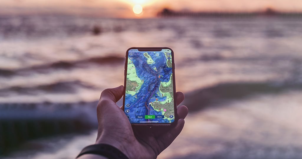
The Navionics Boating App provides users with internationally renowned Navionics charts that can be used offline, along with multiple overlays for added convenience. The app's planning tools also make it a standout choice, enabling users to search by latitude and longitude, save markers, and measure distances on the map without hassle. This level of functionality not only enhances the boating experience but also helps ensure a more efficient and safer journey on the water.
Whether a beginner or a seasoned boater, staying informed on the go is essential for a smooth and enjoyable experience. The Navionics Boating App brings together critical features in one user-friendly interface, making it an indispensable resource for those looking to make the most out of their time on the water. With its expansive capabilities and continued updates, this app is set to remain a valuable tool for boating enthusiasts for years to come.
Fundamentals of Navionics Boating App
Apple and Android
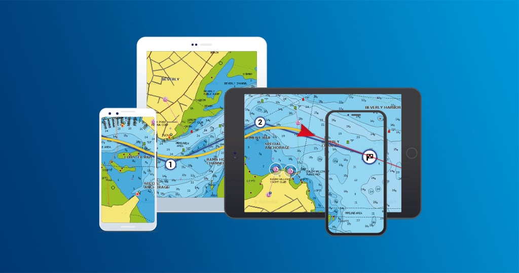
The Navionics Boating App is a versatile tool, compatible with both Apple and Android devices. This allows users to access various features for cruising, fishing, sailing, diving, and other water activities, regardless of their mobile device preference.
Subscription and Free App
While the app is initially available as a free trial, users can continue to enjoy its numerous capabilities with a one-year renewable subscription. The subscription enables seamless access to maps, overlays, and other features necessary for a complete marine experience.
Maps and Overlays
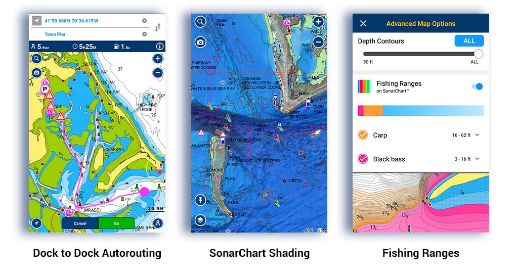
The Navionics Boating App offers an extensive range of internationally renowned Navionics charts. These charts can be used offline, and users can apply multiple overlays to obtain accurate and timely information for their activities on the water. For example, users can access tide height and tidal stream data, tracks, routes, and autoroutes, among other crucial details for smooth navigation.
Chart Data and Updates
One of the app's distinguishing features is its ability to provide daily updates to its chart data. This ensures that users have the most up-to-date information, essential for safe navigation and accurate trip planning. The Boating App Beginners Guide shows users how to search by latitude and longitude, save markers, and measure distances on the map.
By utilizing these fundamental features of the Navionics Boating App, users have access to a comprehensive marine navigation tool that caters to their specific needs and adventures on the water.
Navigational Features
The Navionics Boating App offers a variety of navigational features that enhance your boating experience. In this section, we will discuss some key features, such as Routes and Waypoints, Distance and Auto Guidance+, Plotter Sync and GPX Import/Export, and NMEA and AIS Connections.
Routes and Waypoints
The app allows users to create and manage routes, both manually and automatically. Users can set waypoints on the nautical chart, allowing them to plan their journeys with ease. Features include:
- Adding, editing, and deleting waypoints
- Customizing waypoint icons and names
- Measuring distance between waypoints
- Creating routes by connecting waypoints
Distance and Auto Guidance+
The Distance feature enables users to measure the distance between two points on the map, while the Auto Guidance+ feature takes it a step further by automatically calculating the best route based on the user's boat specifications and the selected waypoints. This intelligent feature ensures a safe and efficient journey by considering factors such as:
- Boat draft
- Navigational hazards
- Depth contours
- Bridge clearances
Plotter Sync and GPX Import/Export
For seamless integration with your existing marine navigation system, the Navionics Boating App offers Plotter Sync and GPX Import/Export capabilities. Users can synchronize their routes and waypoints between the app and their plotter, as well as import and export GPX files, facilitating data exchange with other devices and navigation software. Key benefits of this feature include:
- Simplified route planning and management
- Easy sharing of routes and waypoints with fellow boaters
- Compatibility with various marine navigation systems and software
NMEA and AIS Connections
The Navionics Boating App supports connections to NMEA (National Marine Electronics Association) devices and AIS (Automatic Identification System) data. With NMEA integration, the app can display data from onboard instruments such as:
- Depth sounder
- Wind sensor
- Speed sensor
AIS connectivity enables users to view real-time positions and information of nearby vessels, enhancing situational awareness and safety on the water. This information includes:
- Vessel name
- Speed
- Course
- Destination
These navigational features make the Navionics Boating App a comprehensive and valuable tool for boaters, offering advanced route planning capabilities and seamless integration with existing navigation systems.
Weather and Tidal Information
The Navionics Boating App provides essential information related to weather and tidal conditions that can impact your boating journey. In this section, we will discuss the real-time weather data, weather forecasts and buoys, and information about tides and bottom structure available in the app.
Real-Time Weather Data
The app offers real-time weather data to help you make informed decisions before and during your boating trip. Tap on a wind arrow icon to see the speed and direction of the wind. Additionally, you can view air pressure and water temperature, which can influence your boating experience.
Weather Forecasts and Buoys
Apart from real-time data, the Navionics Boating App also provides daily and hourly weather forecasts, including information on wind speed and direction, air pressure, water temperature, and wave height. This information helps you plan your trip and avoid any potential weather-related issues.
In addition to forecasts, the app can also show data from weather buoys. These buoys collect and transmit information on local weather conditions, allowing you to monitor the situation at your destination or along your planned route.
Tides and Bottom Structure
Understanding tides and bottom structures is crucial for safe and efficient navigation. The Navionics Boating App displays information about high and low tides and hourly changes in tide levels. This information is especially helpful when navigating through shallow waters or planning your arrival and departure times at a marina.
Moreover, the app displays details about the bottom structure, which can be useful in identifying potential hazards, such as rocks or submerged objects, and in locating good fishing spots. The app also shows information about currents, including their speed and direction, which can affect your boat's ability to maintain course and speed.
By providing comprehensive weather and tidal information, the Navionics Boating App helps you make informed decisions and enhances the safety of your boating adventures.
Fishing, Diving, and Cruising
Fishing Spots and Sonar Imagery
The Navionics Boating App is an invaluable tool for anglers seeking the best fishing spots. With its detailed charts and sonar imagery, users can easily locate prime fishing locations, underwater structures, and temperature contours to increase their chances of success. Furthermore, the app includes a wealth of information on local fishing regulations and conservation areas, ensuring responsible and sustainable fishing practices. Additionally, users can mark their favorite fishing spots for future reference, making trip planning a breeze.
Diving Sites and Local Knowledge
Scuba divers and snorkelers alike will benefit from the Navionics Boating App's extensive database of diving sites. With detailed information on underwater topography, marine life, and visibility conditions, divers can plan their excursions with confidence. Local knowledge is crucial for divers, and the app provides users with valuable information such as nearby dive shops, emergency services, and popular diving routes. By taking advantage of the Boating App's nautical charts, divers can explore new underwater environments safely and efficiently.
Marinas, Anchorages, and Points of Interest
For boating enthusiasts, the Navionics Boating App is a must-have resource for planning trips, whether it's a short weekend cruise or an extended sailing adventure. The app features detailed information on marinas, anchorages, and points of interest, allowing users to easily locate suitable mooring spots, fuel stops, and provisioning points. Real-time data on weather conditions, tidal predictions, and current information ensures that boaters can navigate the waters safely and efficiently. Moreover, the app allows users to save and share their favorite routes, and even create customized itineraries for future voyages.
In summary, the Navionics Boating App is an essential tool for fishing, diving, and cruising enthusiasts. Its comprehensive features, such as sonar imagery, local knowledge, and detailed nautical charts, empower users to plan and execute their water-based activities with confidence and ease.
Advanced Features and Customization
SonarChart Live
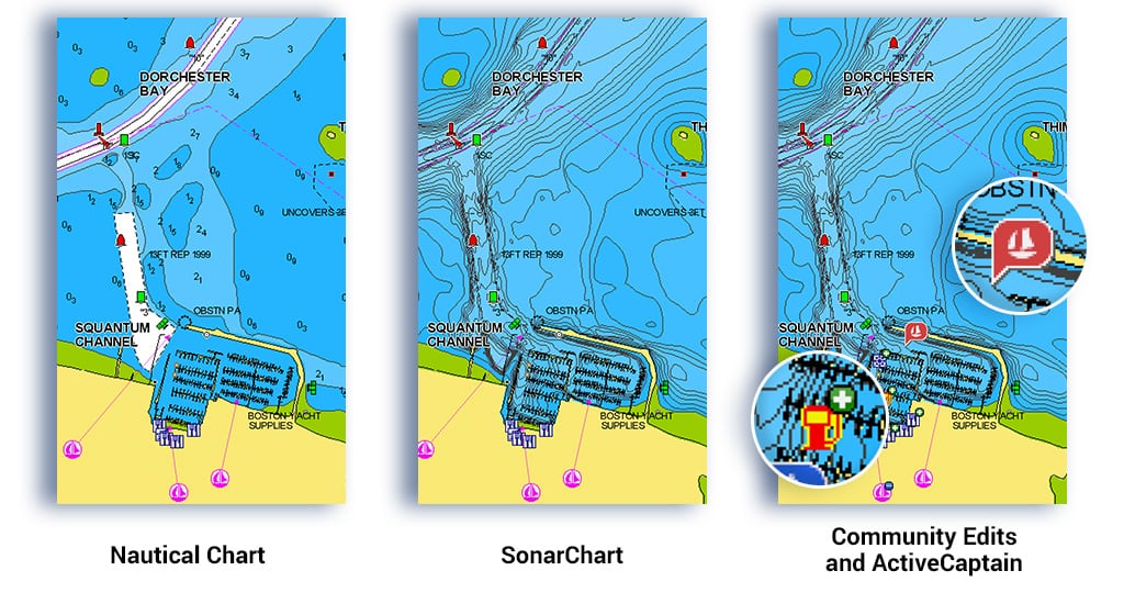
Navionics Boating App offers a powerful feature called SonarChart Live, which allows boaters to create their own real-time bathymetric maps. This feature uses the sonar data from a user's fishfinder or compatible device to display maps and helps boaters to better understand the underwater environment. With SonarChart Live, users can identify key features, like submerged structures or contour changes, and make better decisions for fishing, diving, and general safety.
Satellite Imagery and Relief Shading
Another advanced feature in the Navionics Boating App is the integration of satellite imagery and relief shading overlays. Satellite imagery gives users an aerial view of the area, adding an extra layer of detail to the map. Relief shading, on the other hand, provides an intuitive and visually appealing way to understand depth changes and complex underwater terrain. Combined, these layers offer valuable information for boaters, facilitating safer navigation and enhancing situational awareness.
Map Options and Layers
The Navionics Boating App allows for extensive customization through its map options and layers settings. Users can adjust the level of detail and data displayed on the map like depth contours, shallow water areas, channels, navaids, and markers. Additionally, layers facilitate the visualization of different types of information, such as currents, tides, and wind data. This flexibility allows boaters to tailor the app according to their specific needs and preferences, ultimately leading to a better experience on the water.
Community Edits
A unique aspect of the Navionics Boating App is the integration of community edits. Users can contribute valuable information to the app, such as hazards, points of interest, and underwater structures. By crowdsourcing data, the app becomes more accurate and reliable over time, allowing users to benefit from the collective knowledge of the boating community. Contributing to community edits not only enables safer navigation for all users but also fosters a sense of collaboration and camaraderie among boaters.
Support and Troubleshooting
Help and Recommendations
If you encounter any issues with the Navionics Boating App, it is important to seek help from their support team. You may find helpful resources like the Boating App Academy, which consists of video tutorials that cover various topics related to using the app. This resource can help you learn how to use the app effectively and troubleshoot potential issues.
For more specific problems, the Navionics knowledge base provides articles and guides on app-related topics, such as installing the app, syncing devices, and purchasing options. You can also reach out to their customer support via live chat to get personalized assistance.
Sharing and Live Location
The Navionics Boating App includes features that allow you to share your location and trip information with friends and family. This can be useful when coordinating meetups and ensuring safety while out on the water. To use the sharing and live location services, refer to the app's documentation or seek assistance from customer support if needed.
Alternative Apps
While the Navionics Boating App is a popular choice for many boaters, there are alternative apps available that you may want to consider. Some options include:
- iNavX: A marine navigation app that offers vector marine charts, weather data, and advanced route planning capabilities.
- C-MAP: An app that provides various maps and charts for marine navigation, as well as route planning tools and real-time weather forecasts.
It is essential to research and compare different apps before settling on one that suits your needs best. Keep in mind that each app will have its own learning curve and unique features, so it may take some time to become familiar with utilizing all the provided tools optimally.
Building Local Knowledge
Reading Marinas and Anchorages
The Navionics Boating App provides useful information for boaters to build local knowledge by offering data about marinas and anchorages in their vicinity. Familiarizing oneself with available marinas and anchorages allows for better route planning and decision-making while on the water. The app displays vital information such as the marina's contact details, services offered, and user reviews, which can significantly aid in selecting suitable docking locations.
Identifying Points of Interest and Hazards
In addition to information about marinas and anchorages, the Navionics Boating App also informs users of points of interest and potential hazards in the area. Points of interest may include recommended fishing spots, scenic locations, or waterfront restaurants. These can enhance the overall boating experience while ensuring a safe and enjoyable journey.
Utilizing the app's map overlays and ActiveCaptain Community, boaters can access real-time hazard warnings as well as input from fellow users who may have encountered specific hazards or navigational challenges, increasing local knowledge and situational awareness for everyone.
The Navionics Boating App helps users build local knowledge with its extensive database of marinas, anchorages, points of interest, and hazards, greatly enhancing the boating experience. By constantly updating its information and incorporating user-contributed content, the app remains a reliable and useful tool for anyone looking to explore the waterways and make informed choices while navigating their journey.

Charlie is Editor-in-Chief of Sea Magazine