Intracoastal Waterway Map: A Comprehensive Guide for Navigation
The Intracoastal Waterway (ICW) is a 3,000-mile long inland waterway system that stretches along the Atlantic and Gulf of Mexico coasts of the United States.
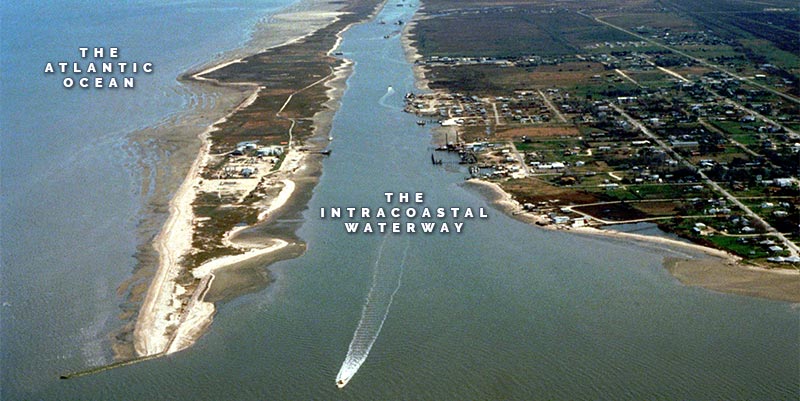
Serving as a vital transportation route for both commercial and recreational vessels, this network of rivers, bays, canals, and inlets provides navigable passage for boats while avoiding the many hazards of the open sea.
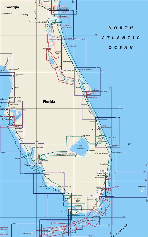
To safely traverse the ICW, accurate and up-to-date maps are essential for boaters, as these charts indicate important information such as water depths, navigation aids, and potential hazards.

Over the centuries, the ICW has experienced significant development, with the U.S. Army Corps of Engineers playing a crucial role in maintaining and improving its infrastructure.
Today, a variety of resources are available for mariners looking to obtain accurate Intracoastal Waterway maps, ranging from printed charts to electronic maps and mobile applications.
Understanding the various aspects of navigating the ICW, such as routing and safety concerns, is vital for a seamless journey along this picturesque waterway.
Key Takeaways
- Intracoastal Waterway maps are essential for navigating the 3,000-mile long network of rivers, bays, canals, and inlets.
- The ICW offers a safe and scenic alternative to the open sea for commercial and recreational vessels.
- Utilizing accurate maps, understanding potential hazards, and being familiar with the ICW's geographic features are crucial for a successful journey.
History and Development
Construction and Expansion
The Intracoastal Waterway started as a vision more than 240 years ago, shortly after the American Revolution. Key government and military leaders saw the need for a safe and secure route for shipping along the Atlantic coast, but not on the open sea1.
The British blockade during the War of 1812 sealed the deal, and parts of the Intracoastal Waterway were in use in the Chesapeake2. In the 1920s, the construction of both Louisiana and Texas Intracoastal Waterways further contributed to the waterway's expansion3.
Military Strategy and World War II
The final push for the completion of the Intracoastal Waterway came during World War II. German submarines sank numerous merchant ships off the East Coast, which underscored the driving urgency to have the waterway connect the Atlantic Ocean and Gulf of Mexico coasts3.
As a result, the waterway ultimately became an essential component of the United States' military strategy during the war.
Modern Usage and Commercial Traffic
Today, the Intracoastal Waterway is a federally maintained, navigable toll-free shipping route, extending for about 3,000 miles (4,800 km) along the Atlantic Ocean and Gulf of Mexico coasts in the southern and eastern United States4.
Commercial traffic, particularly barges, is an important aspect of the waterway's usage5. It connects to inland waterways at various points and utilizes sounds, bays, lagoons, rivers, and canals4, making it accessible for a wide range of vessels, including deep-draft ones.
Footnotes
- [https://grandstrandmag.com/feature/history_and_life_along_the_grand_strand_s_intracoastal_waterway] ↩
- [https://en.wikipedia.org/wiki/Intracoastal_Waterway] ↩
- [https://oceanislebeach.com/history-of-the-intracoastal-waterway/] ↩ ↩2
- [https://www.britannica.com/topic/Intracoastal-Waterway] ↩ ↩2
- [https://www.nationalgeographic.org/article/water-highway/] ↩
Geographic Overview
Atlantic Intracoastal Waterway
The Atlantic Intracoastal Waterway (AIW) is a 3,000-mile (4,800 km) inland waterway located along the eastern coast of the United States, running from Massachusetts to Key West, Florida.
This extensive network of natural and artificial canals, utilizing sounds, bays, lagoons, rivers, and sounds, makes it possible for both deep-draft vessels and recreational boats to navigate safely in many portions1.
Significant parts of the AIW include:
- Chesapeake Bay - The largest estuary in the United States, connecting Norfolk, Virginia, to the Delaware Bay.
- Albemarle Sound - A large shallow coastal water body in North Carolina, offering a crucial waterway passage for inland navigation.
Gulf Intracoastal Waterway
The Gulf Intracoastal Waterway (GIW) is another important component of the United States' Intracoastal Waterway, spanning approximately 1,100 miles (1,770 km) along the Gulf Coast from Florida to Texas.
This waterway provides a vital, protected route for commercial shipping and recreational boating within the Gulf of Mexico2.
Connecting Waterways and Canals
Okeechobee Waterway
Designed to help connect the Atlantic Intracoastal Waterway and the Gulf Intracoastal Waterway, the Okeechobee Waterway spans 154 miles (248 km), cutting across the state of Florida via the St. Lucie River and the Caloosahatchee River. This inland route serves as a critical part of the nationwide waterways system for trade and transportation3.
Chesapeake & Delaware Canal
The Chesapeake & Delaware Canal is a 14-mile (22.5 km) long artificial waterway connecting the Delaware River and the Chesapeake Bay, facilitating the movement of vessels between the AIW and GIW systems4.
Navigation Basics
Understanding Waterway Markers
When navigating the Intracoastal Waterway (ICW), it is essential to understand the various waterway markers.
Channels are marked with Aids to Navigation (ATONs) which include red and green channel markers, reflective yellow squares, and mile markers.
A common phrase to remember the correct order of the markers is "red, right, returning from seaward." This means that when traveling from seaward, the red markers should be on the vessel's starboard (right) side.
In addition to channel markers, there are also range markers, known as range boards. These vertical boards help mariners visually line up a narrow channel to stay on course.
NOAA Charts and Maps
The National Oceanic and Atmospheric Administration (NOAA) provides detailed charts and maps for navigating the ICW.
NOAA charts are essential tools for mariners as they provide accurate information about water depths, bridge clearances, navigational aids, and more.
It is important to regularly update your charts to ensure the most accurate information is available.
Navigating Bridges and Locks
Throughout the ICW, bridges and locks are common features that require careful navigation.
There are different types of bridges, including bascule (draw) bridges, which can open to allow vessels with taller masts to pass through.
Familiarize yourself with the various bridge clearance heights and know the dimensions of your vessel to ensure safe passage.
Locks are designed to help boats navigate through different water levels.
When approaching a lock, communicate with the lock operator, follow any instructions provided, and be prepared with appropriate lines and fenders for a smooth and safe passage.
Safety and Hazards
Maneuvering Through Hazards
One of the primary concerns for mariners navigating the Intracoastal Waterway (ICW) are the various hazards present along its 3,000-mile stretch.
One common hazard is shoaling, which occurs when sand and silt build up in channels, creating shallow areas and potentially grounding boats.
It's essential to pay attention to NOAA charts, as well as local Coast Guard and mariner notices that provide updates on the latest shoaling locations.
Additionally, submerged debris, navigation aids, and bridge pilings can also pose risks to boaters.
To enhance safety, always maintain a vigilant watch and adhere to the correct navigational channels.
Utilizing a detailed map of the ICW also aids in identifying hazards and docking facilities.
Weather Considerations
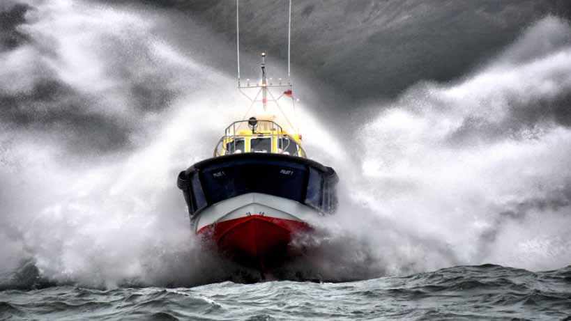
The weather also plays a critical role in ensuring a safe journey on the ICW.
Strong winds, heavy precipitation, and reduced visibility can challenge even the most seasoned mariners.
Before embarking on a trip along the waterway, always check local weather forecasts and make necessary adjustments to sailing plans if needed.
Keep in mind that conditions can change rapidly, making it essential to monitor weather updates throughout the journey.
During specific seasons, the ICW is particularly popular among snowbirds—boaters who migrate south during colder months to enjoy milder climates.
Be prepared for increased vessel traffic during these times, which can contribute to potential hazards and require additional attention.
Recreational Use
Cruising the Waterway
The Intracoastal Waterway (ICW) stretches over 3,000 miles from Boston, Massachusetts to southern Florida, and connects many popular destinations along the East Coast.
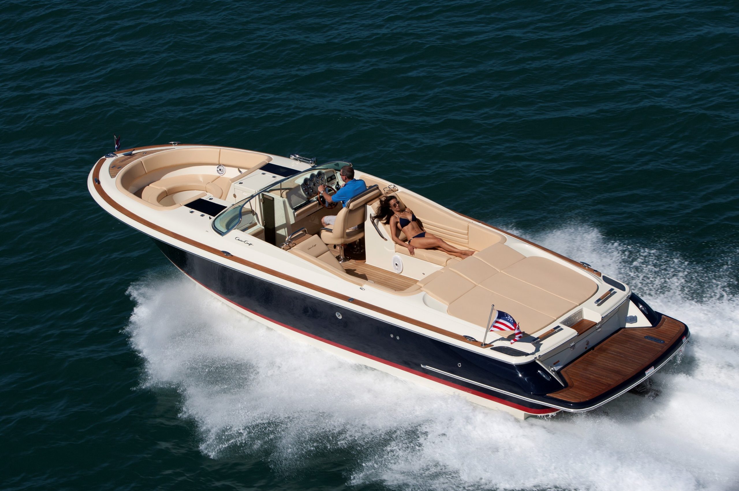
Recreational boaters enjoy cruising along this inland waterway, taking advantage of its well-marked navigation system using markers and charts.
Many popular destinations such as Charleston, Savannah, and Norfolk are accessible on the ICW, making it an attractive route for pleasure craft and leisurely cruising.
The waterway also offers a more sheltered journey compared to open ocean sailing, providing safer passage for recreational boaters.

Marinas and Amenities for Boaters
A variety of marinas and boating facilities can be found along the ICW, offering amenities such as fuel, water, and electricity to boaters. Some marinas also provide overnight docking, allowing travelers to explore the coastal cities and towns they encounter.
Key locations in Virginia, Georgia, and Florida offer numerous marinas for boaters cruising the waterway. For example, the popular Albemarle region in North Carolina has marinas catering specifically to ICW cruisers.
Notable Marinas and Amenities
- Charleston, SC: City Marina
- Savannah, GA: Landings Harbor Marina
- Norfolk, VA: Waterside Marina
Sporting and Leisure Activities
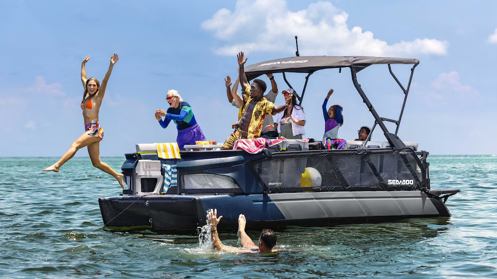
The Intracoastal Waterway is not only used for transportation and cruising, but also offers a wide array of sporting and leisure activities for water enthusiasts.
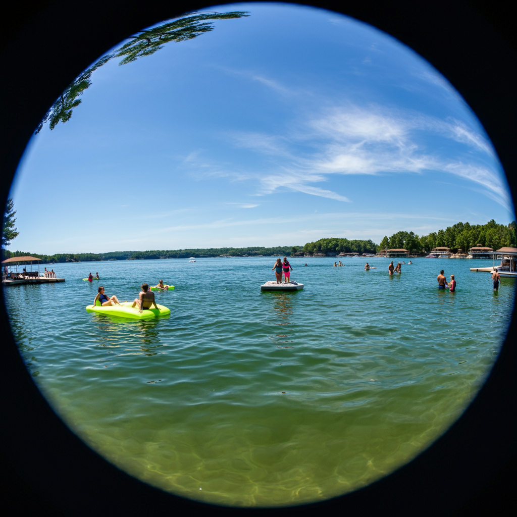
Boating, kayaking, and canoeing are popular along the waterway, while fishing enthusiasts can find ample opportunities for catch and release.
The ICW is also an ideal location for bird-watching, with a diverse range of bird species inhabiting the areas along the waterway.
In southern Florida, the waterway becomes a playground for water sports like jet skiing, paddleboarding, and snorkeling, while beaches along the route provide opportunities for relaxation and swimming.
The rich coastal ecosystems also make the ICW a great destination for eco-tours and wildlife spotting.
Environmental Considerations
Impact on Ecosystems
The Intracoastal Waterway (ICW), a 3,000-mile long inland waterway, is composed of a combination of natural inlets, saltwater rivers, canals, and bays that runs along the Atlantic and Gulf coasts of the United States. This extensive waterway system has a significant impact on the ecosystems located in its vicinity.
Construction and maintenance of the ICW have led to alterations in natural habitats and hydrological patterns. Increased boat traffic may contribute to erosion and sedimentation, which affect the water quality and clarity of the waterway.
The presence of different recreational and commercial vessels can also pose a significant risk to aquatic species, as they may be vulnerable to harmful noise pollution or direct collisions.
Moreover, the ICW facilitates the movement of invasive species, particularly through its interconnected canals. Alien species can rapidly spread through water systems, disrupting ecosystems and negatively impacting native flora and fauna. For instance, an invasive species might consume vast quantities of native plants or animals, leading to an imbalance within the affected ecosystem.
Conservation Efforts
In response to the numerous environmental challenges posed by the ICW, various conservation efforts aim to protect and restore ecosystems along this extensive waterway.
Key initiatives include habitat restoration projects, which involve the removal of invasive species, replanting native vegetation, and monitoring water quality.
Public and private institutions collaborate on these initiatives, and local organizations play a critical role in mobilizing volunteers and providing resources for clean-up programs and awareness campaigns.
Efforts such as coastal cleanups and water quality testing help to maintain the health of the ICW's ecosystems.
Another essential aspect of conservation work is the implementation of regulatory measures. Strict guidelines for boat operation and vessel maintenance help to mitigate pollution, habitat damage, and other long-term impacts on ecosystems.
By enforcing adherence to regulations and supporting community-based conservation projects, the overall health of the ICW and its constituent ecosystems can be protected and enhanced.
Route Highlights
Picturesque Landscapes along the Route
The Intracoastal Waterway is a stunningly diverse and scenic route that features a range of landscapes.
From the tranquil marshes of the Dismal Swamp Canal to the crystal-clear waters of Key West, travelers will be treated to breathtaking views every step of the way.
The route is made up of various bays, sounds, and canals, such as Albemarle, which offer soothing natural vistas and serene settings.
As the waterway makes its way north, boaters will be enthralled by the beauty of historical Cape Cod, with its picturesque lighthouses, pristine beaches, and quaint towns.
The Chesapeake-Albemarle segment of the waterway showcases lush greenery and abundant wildlife, offering a unique, on-the-water nature experience.
Key Destinations and Stopovers
The Intracoastal Waterway is not just about picturesque landscapes; it also boasts a number of key destinations and stopovers that travelers can enjoy.
The vibrant city of Charleston offers a rich history, beautiful architecture, and a lively dining scene, making it an ideal place to relax and indulge.
Further down the route, boaters will find Stuart, the "Sailfish Capital of the World," where they can enjoy exhilarating sportfishing or simply relax on the sandy beaches.
The Gulf Intracoastal Waterway segment offers additional attractions, such as New Orleans, the cultural heart of Louisiana, and the bustling seaport of Mobile Bay.
One cannot forget the Harvey Lock, a critical navigation point near New Orleans that serves as a gateway to the Gulf of Mexico.
Every stop along the Intracoastal Waterway is an opportunity to immerse oneself in the unique culture, history, and natural beauty of the region.
Additional Resources
Apps and Digital Tools
For boaters navigating the Intracoastal Waterway, having access to updated maps and charts is essential.
One excellent solution is AquaMap, an app that provides up-to-date NOAA charts and detailed bathymetry from the U.S. Army Corps of Engineers, covering over 50,000 surveys across the United States.
Moreover, the app includes information on sounds, buoys, dayboards, drop aids, and statute miles.
Another helpful tool is the Intracoastal Waterway Google My Maps, which offers a map of bridges, weather stations, and other points of interest along the waterway.
Boaters may benefit from maintaining a pair of quality binoculars on hand to spot dayboards, buoys, and other navigational aids while traversing inland waterways.
Organizations and Community Groups
Navigating the Intracoastal Waterway, particularly along the Eastern Seaboard and through Georgia's marshlands, can be challenging.
Connecting with organizations and community groups can provide valuable insights and support for boaters.
The Atlantic Intracoastal Waterway Association is one such organization committed to maintaining and improving this vital waterway. Joining or following the activities of this association can be a useful way to stay informed and contribute to the waterway's preservation.
In addition, many sailing clubs and boating communities, such as those with Catboats like the Henry Plummer, organize events and share tips on navigating the inland waters meeting the Atlantic Ocean.
Participating in the community events and sharing experiences with fellow boaters can enhance one's understanding of the challenges and joys of navigating the Intracoastal Waterway.
Frequently Asked Questions
Where can I find a PDF of the Intracoastal Waterway map?
You can check the Atlantic Intracoastal Waterway Association website for available PDF maps. Additionally, the U.S. Army Corps of Engineers and NOAA charts might provide downloadable PDF maps covering certain sections of the waterway.
Are there detailed maps of the Intracoastal Waterway in Florida available?
Yes, there are detailed maps available for the Intracoastal Waterway in Florida. You can find the Intracoastal Waterway Trail map on AllTrails, providing a comprehensive view of the trail with user reviews and ratings.
Is there a Google Maps version of the Intracoastal Waterway?
A custom Google Map of the Intracoastal Waterway is available, displaying bridges, weather stations, and other points of interest along the waterway. You can access it here.
How can I obtain maps of the Gulf Intracoastal Waterway?
Maps of the Gulf Intracoastal Waterway can be found through official government sources like the U.S. Army Corps of Engineers and NOAA charts. Additionally, organizations and websites focused on cruising and yachting may also provide maps and guidebooks covering the Gulf Intracoastal Waterway.
Where can I find information on the New Jersey portion of the Intracoastal Waterway?
You can visit the Yachting World's article on the Atlantic Intracoastal Waterway for a general overview.
For more specific information regarding the New Jersey portion, you can check local marinas, boating organizations, and government websites for detailed information and maps.
Can I access an interactive map of the Intracoastal Waterway for planning a trip?
A highly recommended interactive map for the Intracoastal Waterway is the AquaMap provided by the Atlantic Intracoastal Waterway Association. It offers an overlay of the latest NOAA charts. The map is updated weekly with detailed bathymetry data from the U.S. Army Corps of Engineers.
Charlie is Editor-in-Chief of Sea Magazine

