What Do Red and Green Markers Indicate on a Boat: Essential Guide for Navigators
Navigating the open waters can be an exciting, yet challenging experience for boaters. One of the essential aspects of safe boating is understanding various navigation aids, such as markers that guide sailors through waterways while avoiding potential hazards. Among these markers, red and green markers play a crucial role in directing boats down the proper channels. These markers are known as lateral marks, and when properly identified can help ensure a boater can traverse waterways safely.
Red and green markers on a boat typically designate channel directions, with the red representing the port (left) side of a channel when entering from the seaward end, and the green representing the starboard (right) side of the channel. These colors are vital in helping mariners maintain their course and avoid obstacles or shallow waters. In addition to color, these markers may also include light and number indications, which can assist boaters with further distinguishing them in low visibility conditions or night navigation.
Key Takeaways
- Red and green markers are vital for safe navigation through waterways, indicating port and starboard sides of a channel.
- Markers may include light and number indications, further assisting in distinguishing them during low visibility or nighttime navigation.
- Understanding lateral marks is essential for avoiding hazards and promoting safe boating experiences.
Understanding Nautical Markers
When navigating the waters, it is essential to understand the different types of markers and their meanings. In this section, we will discuss nautical markers, focusing on the red and green markers that are used to indicate navigational channels.
Principles of Buoys
Nautical markers, or buoys, are floating devices anchored to the sea bottom to convey important information regarding water depths, obstructions, and channel locations. They come in various shapes, sizes, and colors to assist boaters in staying within the safe and navigable parts of waterways. The two main types of buoys are lateral and cardinal markers.
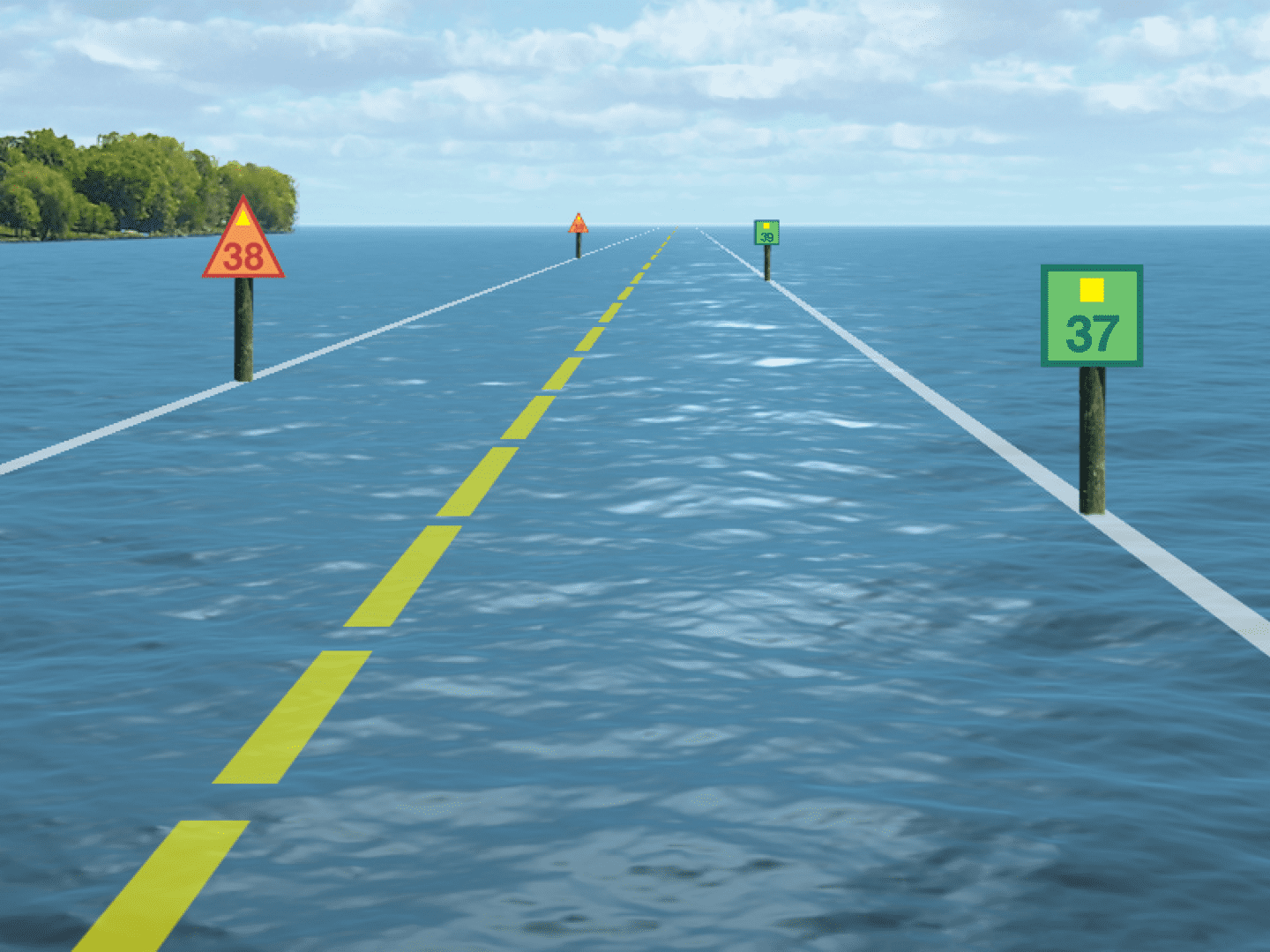
Lateral markers are the most common type of buoys and indicate the sides of a navigable channel. The red markers are typically found on the right side of the channel when traveling downstream and are known as "red, right, returning" in North America. Green markers are placed on the left side, and these markers may have numbers to help skippers keep track of their position within the channel.
| Color | Channel Side | Direction |
|---|---|---|
| Red | Right | Downstream |
| Green | Left | Downstream |
Cardinal markers are used to indicate the safest direction to pass around hazards that can't be indicated through lateral markers. They have four different types, each representing one of the cardinal points (North, South, East, West) and are easily identified by their colors and top marks.
Origin of Marker System
The red and green markers, also known as the buoyage system, were initially introduced by a Danish officer named Peter Tordenskjold in the 18th century. The International Association of Marine Aids to Navigation and Lighthouse Authorities (IALA) has since standardized the system, dividing it into two main regions: IALA A and IALA B.
In IALA A, which includes Europe, Africa, Asia, and Australia, red markers indicate the left side of the channel when facing upstream, while green markers indicate the right side. In IALA B, which covers America, red markers are found on the right and green markers on the left when facing downstream.
As you can see, understanding nautical markers is crucial for safe navigation in waters around the world. Familiarity with the lateral marker system, cardinal markers, and the origin of the buoyage system will help ensure safe passage and prevent potential hazards during your boating adventures.
Defining the Colors on Boat Markers
Importance of Red and Green
The color coding of red and green markers on a boat plays a crucial role in ensuring the safety and navigation of vessels. These colored markers, also known as buoys, help boaters identify the correct channels, avoid hazards, and adhere to designated traffic lanes when traversing water bodies. The red and green marker system is universally recognized and used across the maritime industry.
The red markers indicate the starboard (right) side of a channel when a boat is moving upstream or returning from open waters. These markers can appear as red buoys or be painted directly on fixed navigational aids.
On the other hand, green markers designate the port (left) side of a channel in the same circumstances. Like their red counterparts, green markers can be found as buoys or painted on fixed aids.
In addition to red and green markers, white buoys serve various purposes such as mooring, controlling speed, or providing general information about designated areas.
Deciphering Color Codes
Understanding the purpose and placement of red and green markers is imperative for navigators. The following simple rules can be employed to decipher the color codes:
- When moving upstream or returning from open waters, remember the acronym “Red, Right, Returning.” This means that the red markers should always be to the right, while the green markers should be on the left.
- Keep in mind that as you move downstream or towards open waters, the positions of red and green markers will reverse.
The red and green markers may also showcase specific characteristics to differentiate them further:
- Red markers may feature even numbers or lettered signs such as "R2" or "RN."
- Green markers often showcase odd numbers or lettered signs like "G1" or "GN."
- Both red and green markers can be illuminated with flashing sequences or constant lights to provide nighttime visibility.
By understanding and following the color codes of red and green markers, as well as maintaining an awareness of other buoy colors, boaters can safely navigate waterways with confidence and ease.

Light and Number Indications
Light Patterns
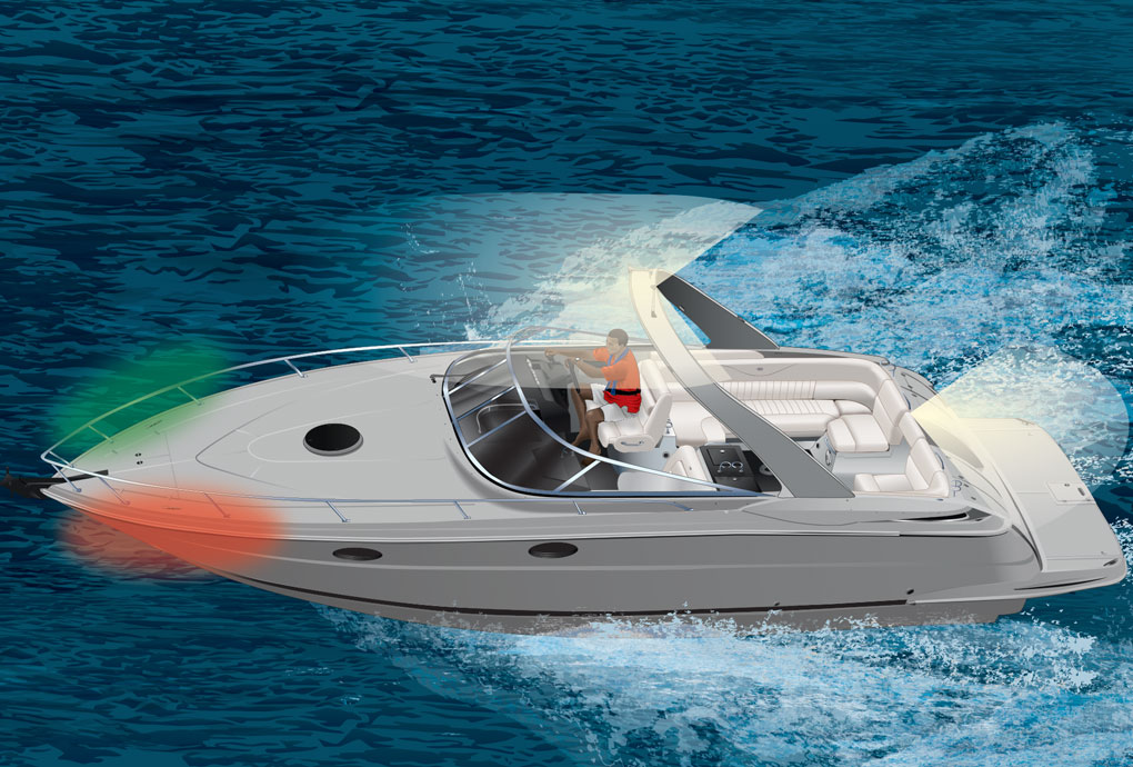
On a boat, the red and green markers indicate the navigational lights that help in determining its position and direction. The red light is typically positioned on the port (left) side of the boat, while the green light is on the starboard (right) side. These lights are essential during nighttime navigation, allowing other vessels to determine the boat's heading and ensure safe passage.
Besides the red and green lights, boats may also have a white light, usually at the stern or rear of the vessel. This white light is sometimes combined with a masthead light, allowing for a 360-degree visibility around the boat.
Numbers on Markers
In some cases, red and green markers may also include numbers, which serve as a navigational aid and a means of identification. These numbers are often associated with the vessel's registration or permit. In general, odd numbers are linked to the red markers, while even numbers are associated with the green markers.
The use of odd and even numbers on navigational markers helps in distinguishing the directions and keeping track of the waterways. For instance, in the U.S., the United States Coast Guard's (USCG) Navigational Aid System uses odd-numbered red buoys on the starboard side when entering a harbor, and even-numbered green buoys on the port side. This system enables mariners to navigate safely, ensuring they are on the correct side of the channel.
To sum up, red and green markers on a boat play an essential role in both nighttime navigation and identification. The lights provide necessary information about the direction and position of the vessel, while the associated numbers, in some cases, offer further guidance on waterway channels and contribute to the boat's overall identification.

Exploring Different Types of Markers
Boating enthusiasts and professionals alike need to navigate the water safely to prevent accidents and collisions. This section will discuss various types of markers, such as red and green markers, that help mariners identify important information while navigating.
Mooring Buoys and Their Uses
Mooring buoys are floating devices that provide a place for boats to securely attach, preventing them from drifting away. There are different types of mooring buoys, distinguished by their shape and color. For instance, a port hand buoy features a red color and indicates the left-hand side of a channel when entering a harbor. A starboard hand buoy, marked in green color, denotes the right-hand side of the channel.
Apart from port and starboard hand buoys, other key types of buoys include:
- Isolated danger buoy: These buoys, marked with black and red stripes, warn boaters of an isolated hazard in the water.
- Bifurcation buoy: Bifurcation buoys, also known as junction buoys, are colored in both red and green. They signal the branching of a channel and help determine the main channel's direction.
- Special buoys: Specialized buoys like diving buoys or swimming buoys, with distinct colors and markings, caution boaters to stay away from restricted areas.
Lighthouses as Navigational Aids
Lighthouses serve as essential aids to navigation by providing a visible and often audible (foghorn) signal to nearby vessels. They stand on shorelines, islands, or other significant points along coastlines and are typically painted with distinct colors or patterns to distinguish them from one another.
Some lighthouses have range markers or green and red flashing lights to help guide vessels through narrow channels or other difficult-to-navigate areas. The range markers serve as a navigation tool when boaters align them, indicating they are on the right course.
Other Key Types of Buoys
Additional navigational markers, such as cans, pilings, or even beacons, contribute to ensuring safe navigation in various waterways.
- Cans: These cylindrical buoys are often colored either green or red to signal port and starboard sides, just like port and starboard hand buoys, marking a safe path through channels.
- Pilings: Pilings are sturdy, vertical posts driven into the seabed and are used for various purposes, like mooring, lighting, or marking channels. Their colors can indicate specific information for boaters.
- Beacons: Beacons are fixed navigational aids, often mounted on pilings or rocks near the shore, and use either flashing lights or reflective materials to help boats navigate through hazardous areas or along waterways.
In conclusion, the various navigational aids, like red and green markers, lighthouses, and different types of buoys, provide crucial assistance to mariners. Understanding these markers and how to interpret their signals is vital for safe and efficient navigation.

Understanding Channel Directions
Channel Markers and Navigation
Navigating through rivers, lakes, and open sea requires a clear understanding of channel markers. These markers indicate the direction of safe passage by differentiating the port and starboard sides. Channel markers come in two main colors: red and green. Generally, red markers indicate the port side, while green markers represent the starboard side.
When navigating in a channel, boaters should keep the red markers on their port side and the green markers on their starboard side. This guidance helps them steer clear of potential hazards, such as shallow waters or submerged rocks.
Interpreting Channel Splits
Channel splits can be a bit more complex than simply following the red and green markers. At junctions, boaters might encounter a preferred channel marker, which indicates the primary route they should follow. These markers are usually striped red and green, with the dominant color indicating the side to keep the marker on.
For example, a marker with more red than green implies that boaters should keep the marker on their port side, and vice versa. In cases where the preferred channel is not clearly marked, boaters may have to use their intuition and consult nautical charts, tide tables, or other navigational tools to ensure safe passage.
Differentiating Port and Starboard
The most important aspect of understanding channel directions is differentiating between port and starboard. In maritime terms, port refers to the left side when facing forward, and starboard refers to the right side.
By adhering to the channel markers (red on the port side, and green on the starboard side), boaters can effectively follow the traffic flow and maintain a safe distance from potential hazards. Remembering the "red-right-returning" rule can also be helpful in many regions – if returning from the open sea or the sea buoy, keep the red markers on your starboard side.
In summary, successful navigation through channels relies on confidently interpreting channel markers, understanding channel splits, and accurately differentiating between port and starboard. With these skills, boaters can safely travel along rivers, lakes, and open seas.

Navigation Hazards
Identifying Isolated Dangers
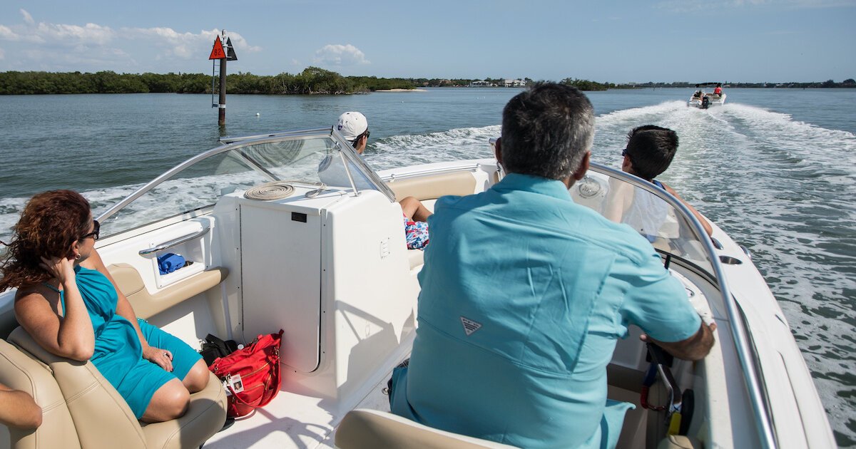
Isolated dangers are hazards found in a navigational area that pose a risk to a vessel's safety. These can include submerged rocks, wrecks, or sandbanks that are not marked on navigation charts. Red and green markers on a boat, also known as navigation aids, help mariners identify and avoid these isolated dangers. The red markers, often referred to as "nun buoys," indicate the port (left) side of the channel when returning to harbor, while the green markers, or "can buoys," signify the starboard (right) side.
In addition to color-coded markers, some navigational aids may also have distinctive shapes, topmarks, or lights, which provide further information on the navigational hazards in the area. Mariners must remain vigilant and cautious when navigating near isolated dangers, adjusting their course and speed accordingly to ensure safety.
Hazards in Open Water
Open water navigation presents its own set of challenges and hazards, such as the presence of other vessels, floating debris, or changes in water depth. To ensure safe passage, mariners rely on red and green markers to identify the recommended navigational channels.
Furthermore, floating aids, such as lateral buoys or cardinal buoys, may also be used to indicate hazards in open water. These buoys are marked with unique combinations of colors, shapes, and reflective materials, making them easily identifiable during both day and night navigation.
Rocks and Other Obstacles
Rocks, reefs, and other underwater obstructions can pose significant risks to vessels navigating in unknown or shallow waters. Red and green markers are invaluable tools for mariners to identify and avoid these hazards.
In some cases, a charted rock or obstruction may be marked by a "danger buoy" – a buoy with alternating red and white vertical stripes. Mariners should keep a safe distance from such hazards and follow the red and green markers to maintain a safe course.
By using red and green navigation aids, mariners can confidently navigate through various navigational challenges and hazards, ensuring the safety of both vessel and crew.
Special Markers and Regulations
In this section, we will discuss special markers and regulations related to boating, focusing on safe water areas and speed regulations, as well as control buoys and their uses.
Safe Water Areas and Speed Regulations
Safe water areas are designated regions where boats can navigate without the risk of running aground, colliding with other vessels, or encountering hazards. They are marked by red and green markers, which serve to guide boaters through these areas. Red markers are on the left (port) side of the channel when returning from the sea, while green markers are on the right (starboard) side.
Speed regulations within safe water areas help maintain safety for all vessels and minimize the risk of accidents. These speed limits can vary depending on the location and may be indicated on control buoys. It's essential for boaters to adhere to these speed regulations to ensure the continued safety of all vessels in the area.
Control Buoys and Their Uses
Control buoys are special navigational aids that serve various purposes in boating, such as displaying speed limits, marking safe water areas, or highlighting areas where boat traffic is restricted. They typically have a flat top and can be permanently fixed or floating.
- Speed Limit Buoys: These control buoys display speed limits for vessels in designated areas. They often have the speed limit written on them and may also feature traffic lights to indicate when the speed must be adjusted.
- Safety Buoys: These buoys mark safe water areas and help guide boaters safely through channels, thus reducing the risk of grounding or collisions.
- Keep Out Buoys: These control buoys mark areas where boat traffic is restricted or prohibited, ensuring that boaters keep a safe distance from hazards or other activities happening in those zones.
It is crucial for boaters to recognize and follow the guidance provided by these special markers and adhere to the regulations set forth for each area. In doing so, they contribute to the overall safety of the waterways and help preserve the enjoyment of boating for all.
Advanced Boating Knowledge
Boating Skills and Techniques
Boating requires mastering numerous skills and techniques to ensure safe navigation. One key aspect of this is understanding the various aids to navigation presented by the United States Coast Guard. These aids help boaters identify their position on the water and navigate safely around obstacles. Some of the essential boating markers include:
- Anchorage buoy: Indicates designated anchorage areas.
- Special: Signifies special information or instructions for mariners.
- Red and green markers: Indicate the sides of channels and navigable paths.
- Day beacons: Guide boats through shallow waters and around hazards.
- Bifurcation: Marks a junction where a channel splits into two.
By familiarizing themselves with these markers, boaters can develop better navigation skills and avoid dangerous situations on the water.
Understanding the 'Red Right Return' Rule
A fundamental rule in boat navigation is the Red Right Return. This rule states that when entering a channel or returning from the open sea, the red markers (like buoys or day beacons) should be on the boat's right side (starboard), and the green markers should be on the left side (port). Some specific red and green markers include:
- Red and green buoys: These can be found on either side of the channel, indicating the safe passage for boats.
- Starboard junction day beacon: A red triangular sign denoting the junction of two channels; keep it to the right when proceeding upstream.
- Port junction day beacon: A green square sign indicating the junction of two channels; keep it to the left when navigating upstream.
- Starboard hand day beacon: A red beacon marking the right side of the channel.
- Port hand day beacon: A green beacon marking the left side of the channel.
It is crucial for boaters to understand the 'Red Right Return' rule as it helps them follow the correct course when navigating channels and aids in avoiding potential hazards.
In addition to red and green markers, mariners should also be aware of cardinal marks, which indicate the safest direction to pass an obstruction (North, East, South, or West).
By developing a firm understanding of boating skills, techniques, and navigation markers, including red and green markers, mariners can improve their ability to navigate efficiently and safely.

Frequently Asked Questions
What is the purpose of red and green buoys in navigation?
Red and green buoys, also known as channel markers or lateral markers, are used to indicate the safe path for boats to navigate through a waterway. These markers are designed to help boaters identify the edges of channels and avoid running aground or colliding with underwater obstructions.
How should a boat navigate between red and green markers?
When navigating, a boat should align itself between the red and green markers, with the red buoys on the port (left) side and the green buoys on the starboard (right) side. This arrangement helps boaters maintain a safe course through channels and other navigational hazards.
What is the significance of a boat's port and starboard side in relation to marker colors?
The port side (left) of a boat aligns with red markers, and the starboard side (right) aligns with green markers. This color-coding system exists to simplify nautical navigation, ensuring that boaters maintain a safe course when moving through channels.
How do channel markers assist in safe boating?
Channel markers, including red and green buoys, guide boaters through safe water passages. By following these markers, boaters can avoid running aground, colliding with other vessels, or encountering underwater hazards such as rocks and sandbars.
What are the rules for passing buoy markers when entering a harbor?
When entering a harbor, it is important for boaters to follow the navigational "red, right, returning" rule. This rule states that red markers should be on the boater's right (starboard) side when returning or entering a harbor, while green markers should be on the left (port) side.
How do lateral markers differ from other types of buoys?
Lateral markers, which include red and green buoys, are used specifically to mark the edges of channels and safe passages. Other types of buoys, such as cardinal markers, danger markers, and special purpose markers, serve different functions in navigation, providing information about water depths, potential hazards, or designated use areas.
Q&A With Local USCG Station
Charlie (Sea Magazine): Good morning, Lieutenant Smith, thank you for joining us today to discuss an essential topic in boating - navigation lights and markers. The understanding of these can be quite complex for many boat operators. Could we start by discussing the primary channel and secondary channel? What do the red and green markers indicate in these water channels?
Lieutenant Smith (US Coast Guard): Of course, Charlie. In the primary channel, the red and green markers help guide the boat operator. When heading upstream, the red markers will be on your right, indicated by red buoys or even red and green bands on channel buoys. Conversely, the green channel markers, often green buoys with green bands, will be on your left.
Charlie: How about in a secondary channel? And could you explain the meaning of the green buoy and other important markers?
Lieutenant Smith: Sure. In a secondary channel, you might find bifurcation markers. These are important because they guide you between the primary and secondary channels. Green buoys in these areas could indicate the secondary channel, while red buoys mark the primary one.
Charlie: Interesting. Now, what about different shapes? I understand there are triangular shapes, cone-shaped markers, and horizontal bands. What are their meanings?
Lieutenant Smith: Different shapes serve as traffic signs on the water. Triangular and conical shapes often denote green channel markers. Red markers might be presented as horizontal bands. Cone-shaped markers usually mark the port side when heading upstream.
Charlie: And what about mooring buoy colors or other colors like red, green, yellow squares, and their angles?
Lieutenant Smith: Mooring buoy colors can include blue and white, helping other boaters identify them. Yellow squares may indicate special features or information, while the angles and shapes of the markers signify their specific meanings, such as bifurcation markers to navigate around sandbars.
Charlie: Speaking of which, how does this all apply to the intercoastal waterway? I assume the understanding of these signs is vital there, considering the different water channels?
Lieutenant Smith: Absolutely, the intercoastal waterway can be seen as a conical map filled with important markers. Upstream refers to moving against the current, and having knowledge of red colors, green colors, and the various markers helps navigate the dense and intertwined channels.
Charlie: One last question for our reader-supported magazine, what are the general rules for boat navigation lights, especially at night or during poor visibility?
Lieutenant Smith: Boat navigation lights are crucial for safety. Generally, you'll have a red light on the port side, a green light on the starboard, and a white light at the stern. These help other boaters identify your direction and position. It's much like following the rules of the road but on the water.
Charlie: Thank you, Lieutenant Smith. Now, continuing on our conversation, let's dive deeper into the meaning of green and red buoys. We've touched on them briefly, but what are their specific roles in a water channel, and what does the triangular shape signify?
Lieutenant Smith: Green and red buoys & channel marker play a vital role in navigation, especially in the complex networks of the Intracoastal Waterway. Green buoys, often with a conical top, signify the right side of the channel when heading upstream. The triangular shape in green buoys helps with quick recognition. Red buoys, on the other hand, mark the left side of the channel under the same circumstances.
Charlie: That clears up the green buoy meaning quite well. Now, how about yellow triangles? Where might we see them, and what do they indicate?
Lieutenant Smith: Yellow triangles are special purpose markers. They can be used to mark areas such as swimming zones, anchorage areas, or even to give information about things like sandbars. They provide an additional layer of information to the boat operator and help in navigating the water channels safely.
Charlie: Speaking of sandbars, what are some typical markers that warn about sandbars, and how should boaters navigate around them?
Lieutenant Smith: Sandbars are often marked with specific warning signs, like bifurcation markers or even red markers, which might contain information on how to navigate around them. A red buoy with horizontal bands could be used to signal the safest path around the sandbar. Understanding the specific meanings of these markers is crucial for safe navigation in areas where sandbars are common.
Charlie: The Intracoastal Waterway seems to be a recurring theme in our discussion. Can you explain why understanding these markers is particularly vital in the context of the Intracoastal Waterway?
Lieutenant Smith: Certainly. The Intracoastal Waterway is a complex and heavily trafficked network. It combines primary and secondary channels, includes multiple sandbars, and has a myriad of green and red buoys, along with other markers like yellow triangles. The system can be thought of as a conical map, with different layers of information that guide vessels safely through these congested waterways. A deep understanding of these markers is not just beneficial; it's essential for safe navigation.
Charlie: Your insights today have been invaluable, Lieutenant Smith. I'm sure our readers will greatly appreciate this detailed information, enhancing their understanding and safety on the water.
Lieutenant Smith: I hope so, Charlie. Navigating our waterways can be as enjoyable as it is complex. Knowing the meanings of these markers, from the green buoy to the red marker, is key to safe and confident boating. Thank you for having me, and I wish all your readers safe travels on the water.
Charlie: Thank you, Lieutenant Smith, and thanks to the Coast Guard for all the work you do to keep our waterways safe. It's been a pleasure.

Charlie is Editor-in-Chief of Sea Magazine