Longboat Pass Inlet
Weather
Longboat Pass Inlet is a stunning destination located about nine miles southwest of Bradenton and 21 miles south of St. Petersburg. The inlet provides a reliable, albeit shallow, entrance to Anna Maria Sound, which finds itself at Mile 85 in the Gulf Intracoastal Waterway. This scenic location attracts both locals and tourists, making it a key spot for boating, fishing, and enjoying nature's beauty.
The mean tidal range in Longboat Pass averages 1.5 feet, and the currents ebb and flow at an average velocity of 1.6 to 1.8 knots. The inlet serves not only as a vital connection to the Gulf of Mexico but also provides access to Sarasota Bay and the sheltered waters running from Sarasota, past Longboat Key, and up to Bradenton.
When navigating the waters of Longboat Pass Inlet, more...
Longboat Pass Inlet: A Comprehensive Guide to This Coastal Gem
Longboat Pass Inlet is a stunning destination located about nine miles southwest of Bradenton and 21 miles south of St. Petersburg. The inlet provides a reliable, albeit shallow, entrance to Anna Maria Sound, which finds itself at Mile 85 in the Gulf Intracoastal Waterway. This scenic location attracts both locals and tourists, making it a key spot for boating, fishing, and enjoying nature's beauty.
The mean tidal range in Longboat Pass averages 1.5 feet, and the currents ebb and flow at an average velocity of 1.6 to 1.8 knots. The inlet serves not only as a vital connection to the Gulf of Mexico but also provides access to Sarasota Bay and the sheltered waters running from Sarasota, past Longboat Key, and up to Bradenton.
When navigating the waters of Longboat Pass Inlet, it is essential to remember that the channel depth can be quite shallow and constantly shifting. Despite its depth, the inlet remains fairly reliable and safe in most conditions. Boaters and anglers venturing into this area will be rewarded with a magnificent waterscape, an abundance of marine life, and unforgettable memories.
Location and Geography
Florida West Coast
Longboat Pass Inlet lies along Florida's West Coast. It provides an entrance to Anna Maria Sound from the Gulf of Mexico, located about nine miles southwest of Bradenton and 21 miles south of St. Petersburg 1.
Manatee County
Longboat Pass Inlet is part of Manatee County, with the inlet's surroundings predominately consisting of the hamlets Longbeach and Whitney Beach, as well as shorelines from various surrounding islands 2.
Surrounding Islands
The inlet is situated near several islands, such as Longboat Key and Anna Maria Island. On the north side, it is adjacent to the Manatee County Shore Protection Project, serving Anna Maria Island 3. Meanwhile, south of Longboat Pass, we find the Sarasota County Shore Protection Project-Longboat Key Segment 3. The inlet's proximity to Sarasota Bay highlights its importance as a central point connecting various aquatic ecosystems in the region.
Longboat Pass Inlet has various nearby attractions like the Florida Maritime Museum, Coquina Beach, and opportunities for recreational activities along the shoreline. Its central location along the West Coast of Florida makes it an ideal spot for boating, fishing, and exploring the natural resources that the region has to offer.
History and Construction
Longboat Pass Inlet, situated on the southwest Gulf of Mexico coast of Florida, has a rich history that dates back to the 1880s. During this period, the inlet underwent a natural evolution, which was significantly influenced by factors such as tidal currents and coastal sediment transport processes prior to any human interventions. In addition to this, several inlet modifications took place over the years, which aimed at enhancing the functionality and safety of the inlet for both navigation and shoreline protection purposes 1 2.
The construction of Longboat Pass Inlet is particularly notable due to its connection to the Gulf Intracoastal Waterway, a major shipping and transportation corridor for both commercial and recreational vessels. To better facilitate navigation, the inlet was initially constructed in 1977. Since its construction, there have been two main federal shore protection projects undertaken in the area. These projects included the Manatee County Shore Protection Project (MCSPP), which served Anna Maria Island to the north, and the Sarasota County Shore Protection Project-Longboat Key Segment (SCSPP-LK), which served Longboat Key to the south 3.
An essential aspect of the inlet's construction and ongoing maintenance involves the implementation of jetties. These structures have been built to stabilize the inlet, prevent sand migration, and maintain navigation channels. The Longboat Pass study provided an analysis of the inlet's evolution from the 1880s to the present and discussed the impacts of jetty construction and inlet dredging on the ongoing processes at the inlet 4.
Finally, it is important to acknowledge how the inlet management strategies have been adapting over time. One of the more recent efforts has been the development of an integrated plan for managing Longboat Pass. This plan focuses on several critical factors, including navigation, beach erosion, and beach renourishment, which are vital to ensuring the long-term sustainability of the inlet and its surrounding environment 5.
Navigation and Safety
Aids to Navigation
Navigating through the Longboat Pass Inlet can be challenging due to constantly shifting channels and water depths. To assist boaters, there are aids to navigation provided by the U.S. Coast Guard. These aids include a buoy system, Morse (A) light, and clearly marked channels. Maintaining a safe course in these waters is essential to avoid potential hazards such as shoaling and underwater obstructions. Be sure to consult the appropriate navigational aids before entering the inlet.
NOAA Chart 11425
To ensure safe navigation in the area, boaters should refer to the NOAA Chart 11425, which covers Longboat Pass Inlet and adjacent waters. This chart provides detailed information on the following:
- Depths and channels: displaying current depths and navigable channels.
- Coastlines and adjacent landmarks: highlighting important coastal features such as St. Petersburg, Bradenton Beach, Longboat Key, and Lido Key.
- Approaches and passes: indicating the safest routes to take when entering or leaving the inlet.
- Obstructions and hazards: marking underwater dangers such as shoals, rocks, and wreckage.
Boaters should carry an updated version of Chart 11425 onboard and review it frequently to ensure a safe passage through Longboat Pass Inlet.
Local Notices to Mariners
The U.S. Coast Guard regularly issues Local Notices to Mariners, providing critical updates on navigational issues impacting waterways such as Longboat Pass Inlet. These notices can cover changes in channel depths, buoy relocations, or alerts about hazards such as shoaling. Boaters should regularly check for local notices affecting Longboat Pass Inlet, as well as nearby areas such as San Carlos Bay, Fort Myers Beach, Cape Coral, Okeechobee Waterway, and Sanibel Island.
Monitoring Local Notices to Mariners is crucial for boaters navigating through the Longboat Pass Inlet, as the inlet's conditions can change rapidly. Keeping up-to-date with these notices ensures a safe and enjoyable boating experience in the area.
Shifting Sands and Inlet Evolution
Longboat Pass is a tidal inlet in southwest Florida that connects the north part of Big Sarasota Bay to the Gulf of Mexico. This inlet is part of a large multi-inlet bay system and plays a vital role in the coastal dynamics of the region.
One significant aspect of Longboat Pass is the presence of shifting sands and the resulting inlet evolution. Tidal currents, wave action, and human interventions (such as dredging) constantly influence the movement of sand within the inlet and its surrounding areas. This movement contributes to the formation of various features such as shoals, bars, and channels. In particular, the formation and migration of the ebb shoal, a sand deposit formed by outgoing tidal currents, can significantly impact the inlet's evolution.
The long-term evolution of Longboat Pass and similar inlets has been the subject of numerous studies, including one that proposes a methodology for modeling the long-term evolution of multiple inlet systems in southwest and central Florida. This methodology takes into account large temporal and spatial scales to better understand the complex interactions between natural processes and human interventions in the inlet's development.
Research into the cumulative effects of channel and ebb shoal dredging on Longboat Pass and its evolution have been performed using the Inlet Reservoir Model. Dredging activities, which have been conducted over the years for navigation purposes, can disrupt natural sand transport processes, leading to changes in the inlet's morphology and potentially affecting neighboring coastal environments.
In conclusion, the intricate interplay between shifting sands, natural processes, and human interventions is an essential factor in Longboat Pass Inlet's evolution. Understanding these dynamics can provide valuable insights for coastal management strategies, particularly in preserving the delicate balance between maintaining navigation channels and protecting the surrounding ecosystem.
Dredging and Inlet Management
Florida Department of Environmental Protection
The Florida Department of Environmental Protection plays a pivotal role in regulating dredging and inlet management projects around Longboat Pass Inlet. This includes ensuring that such projects conform to environmental guidelines and aim to minimize coastal erosion through regional sediment management (RSM) practices.
Parks and Natural Resources
Longboat Pass Inlet is of ecological and recreational importance to the surrounding area. The Parks and Natural Resources Department works together with the Florida DEP and other stakeholders to ensure that inlet management proposals align with ecological conservation goals. An example of this collaboration is the study of the Inlet management of Longboat Pass and adjacent beaches, completed in 2011, which proposes a combination of structures and channel dredging.
Funding Request
Obtaining funding for inlet management projects is crucial to their success. Local governments, in collaboration with state and federal agencies, submit funding requests for essential maintenance and navigational improvements, such as dredging and sediment management. It is important that these proposals include feasible budgets and align with environmental regulations.
Design and Permitting
A meticulous approach to design and permitting is required for successful inlet management. This process includes analyzing the potential impacts of a project on the coastal environment, obtaining relevant permits from local, state, and federal agencies, and creating a comprehensive project design that minimizes negative impacts on coastal ecosystems.
In summary, dredging and inlet management at Longboat Pass Inlet involves collaboration between numerous government agencies and stakeholders. By focusing on ecological preservation, comprehensive design, and responsible permitting, these entities work together to ensure that both the navigational and environmental needs of the inlet are met.
Marinas and Local Facilities
Longboat Pass Inlet, located about nine miles southwest of Bradenton and 21 miles south of St. Petersburg, provides a reliable, albeit shallow, entrance to Anna Maria Sound from the Gulf of Mexico source.
Several marinas are available near Longboat Pass Inlet. One of the major facilities in the area is the Longboat Key Club Moorings. This full-service marina offers 291 deep-water slips and various amenities, including a white-sand beach and the Portofino Ristorante & Bar, which serves Northern Italian cuisine. The resort also boasts the luxurious Spa, offering over 50 treatments.
Other marinas close to Longboat Key include Dock on the Bay marina, Seafood Shack Marina, and Bradenton Beach Marina. These facilities cater to a wide range of boating needs, providing essential services and leisure activities for visitors.
In terms of local facilities, Venice Inlet is another prominent location along Florida's west coast, offering a regional model of accessible and well-maintained inlets. Venice Inlet is known for its iconic, historic downtown and diverse recreational opportunities.
The mean tidal range in Longboat Pass averages 1.5', with a flood current averaging 1.8 knots and an ebb current of 1.6 knots. Boaters should be cautious on the water and ensure their vessel charts and navigational aids are up-to-date.
In conclusion, the Longboat Pass Inlet area offers excellent marinas and facilities for boaters, as well as a variety of recreational and leisure activities for both on-land and water-based adventures. While navigating through the region, boaters should be cautious of the inlet's shallow waters, stay informed of tidal movements, and make use of the well-established facilities and marinas nearby.
Frequently Asked Questions
What are the tide times at Longboat Pass?
The tide times at Longboat Pass vary throughout the day depending on the date and lunar cycle. It is recommended to check a reliable online source for the most up-to-date tide information.
Are there good fishing spots near Longboat Pass?
Yes, there are good fishing spots near Longboat Pass. The area is known for its rich marine life, making it a popular destination for anglers. Some of the most common fish species caught in and around the Pass include Snook, Redfish, and Tarpon.
How does Longboat Pass compare to Big Sarasota Pass?
While both Longboat Pass and Big Sarasota Pass are inlets in Sarasota, FL, they have different characteristics. Longboat Pass is generally more reliable and shallower, offering easier access to Anna Maria Sound at Gulf Intracoastal Waterway Mile 85. On the other hand, Big Sarasota Pass has a wider confluence with the Gulf of Mexico but has constantly shifting shoals, making navigation more challenging.
What is the New Pass Grill menu?
The New Pass Grill menu varies, but it offers a variety of delicious, casual dining options, including seafood dishes, sandwiches, and other favorites. For the most current menu, it's best to visit the official website or contact the restaurant directly.
What is the depth of the water at Longboat Pass?
The water depth at Longboat Pass can vary depending on the tide and other factors such as weather conditions. However, it is considered a shallow inlet with an average mean tidal range of 1.5 feet.
Is the Longboat Pass Bridge currently open?
The status of the Longboat Pass Bridge can change daily. It operates on a schedule, opening on demand for boaters from 6 AM to 7 PM, with restricted openings every 20 minutes after that. To find the most accurate information on its current status, it's recommended to contact local authorities or check relevant online sources.
Footnotes
Nearby


Boats for Sale Nearby
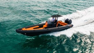
 Center Consoles
Listing Coming Soon
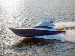
 Sport Fishing
Listing Coming Soon
 Center Consoles
Listing Coming Soon
 Center Consoles